About the District

Brazoria Drainage District No. 4 was created by Brazoria County Commissioners Court on June 28, 1910 and on May 22, 1929, was made a Conservation and Reclamation District by Special Bill No. 25 of the Texas State Legislature. The District is governed by a 3 member elected Board of Commissioners.


Jurisdiction – Brazoria Drainage District No. 4 encompasses an 83.4 square mile area of northern Brazoria County which includes the Cities of Pearland and Brookside Village. Its boundaries from west to east are Fort Bend County to Galveston County and from Clear Creek (Harris County) to a point just north of Alvin, Texas and Manvel, Texas. Major drainage arteries include: Clear Creek, Hickory Slough, Mary’s Creek, Cowarts Creek, Chigger Creek and portions of Mustang Bayou. Principal subdivisions located in the district include: Country Place, Silver Lake, Southwyck, Crystal Lake, West Oaks, Springfield, Sunset Meadows, Sunset Lakes, Meadow View, Pine Hollow, West Wood, Dixie Woods, and Oak Brook Estates.
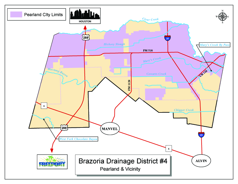
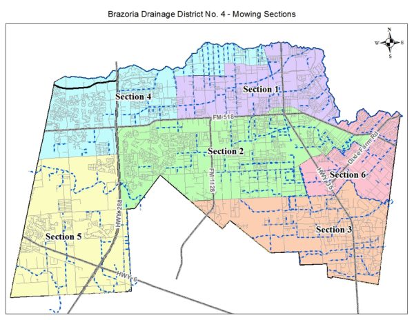
Interactive District Map

Mission – The District is a political subdivision of the State of Texas whose mission is to detain, control, preserve, and distribute the storm and flood waters within its jurisdiction. The District works with local, state, federal, and county agencies to maintain existing flood control systems, construct additions and modifications, and regulate additions and modifications proposed by others. To achieve this mission The District:

1.  Develops sound fiscal procedures to protect taxpayers monies;
2.  Designs near-term and long-term goals and objectives;
3.  Established rules and regulations for drainage development;
4.  Schedules labor force and equipment to meet maximum efficiencies and use there of.

Operations – To carry out its mission the District employs a Superintendent and over 60 full time employees whose primary job is to maintain, reclaim and modify the drainage arteries within its jurisdiction.

The District is responsible for the control of flooding within its boundaries. As such, the district works in conjunction with local state, federal and other county agencies to maintain existing flood control systems, construct additions and modifications and review additions and modifications proposed by others.

Verified by ExactMetrics